Aerial Photographs & Aerial Video on the Humber
We had been waiting for a few weeks for the recent spate of high winds and bad weather to abate so that we could get the drones in the air to do some aerial photography and aerial video on the river Humber for ESH / Lumsden & Carroll ESH and Ouse & Humberside Drainage Board Link to web page.
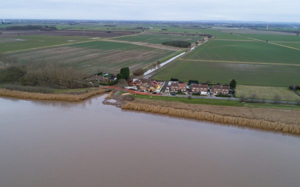
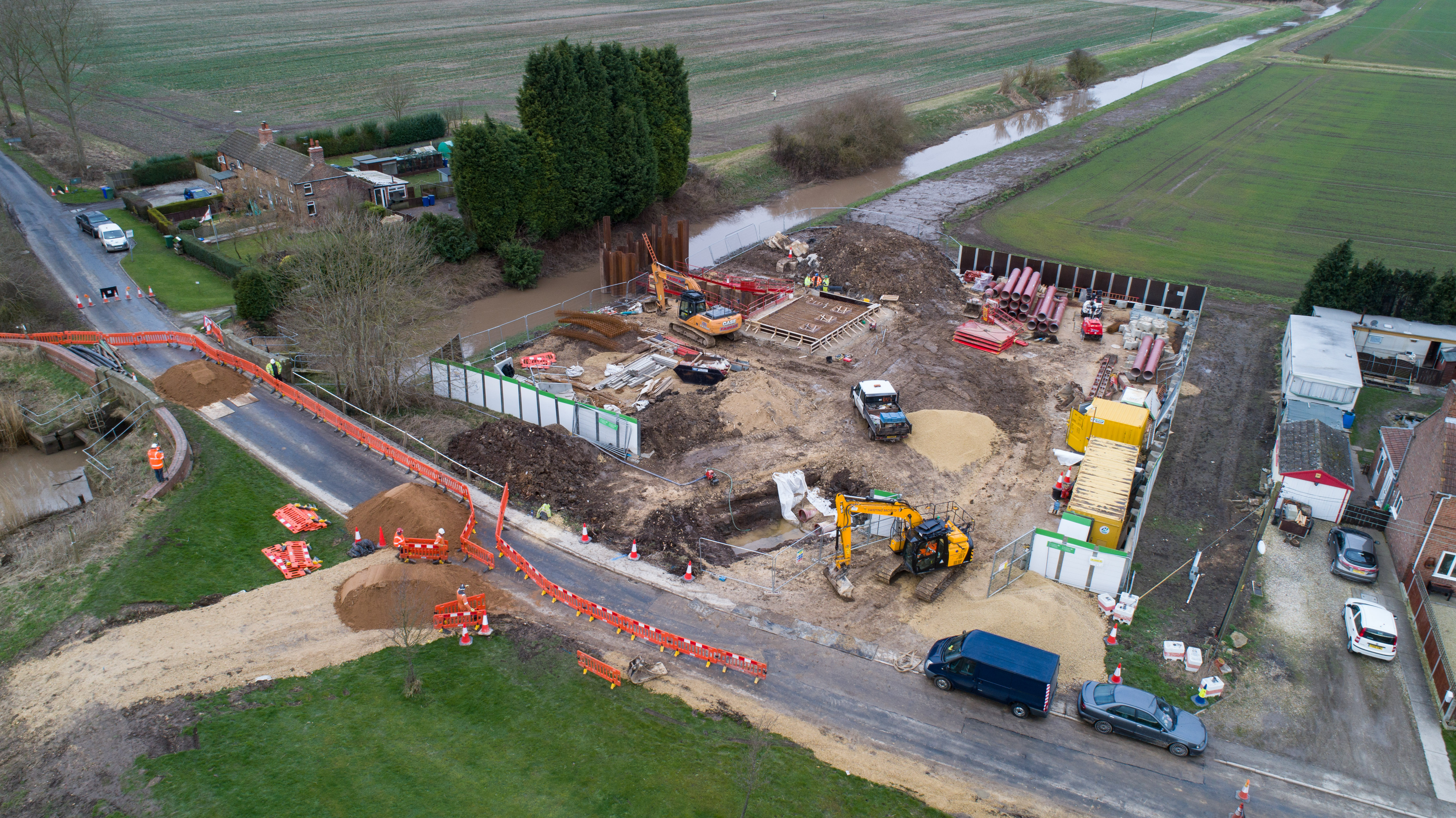
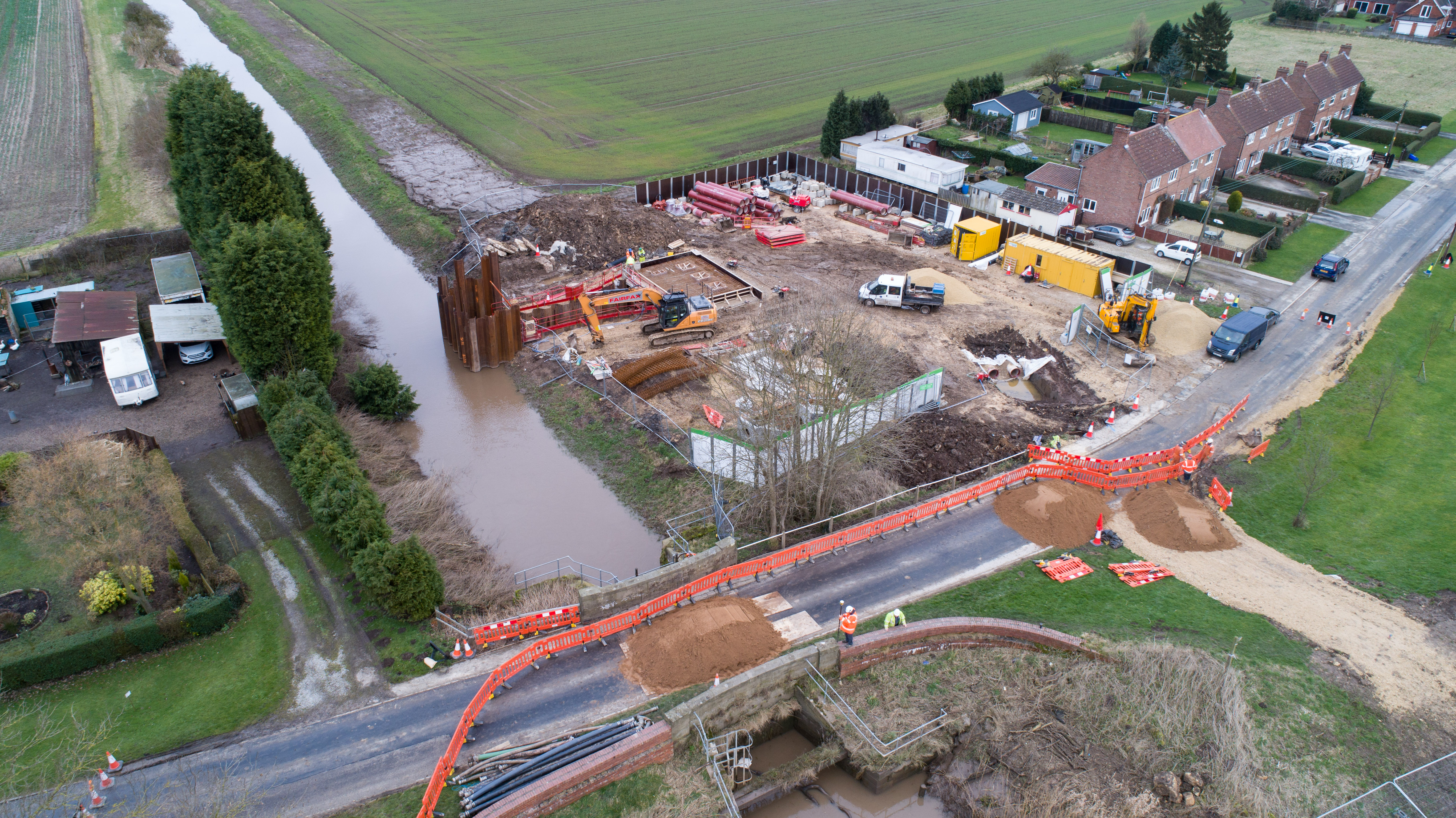
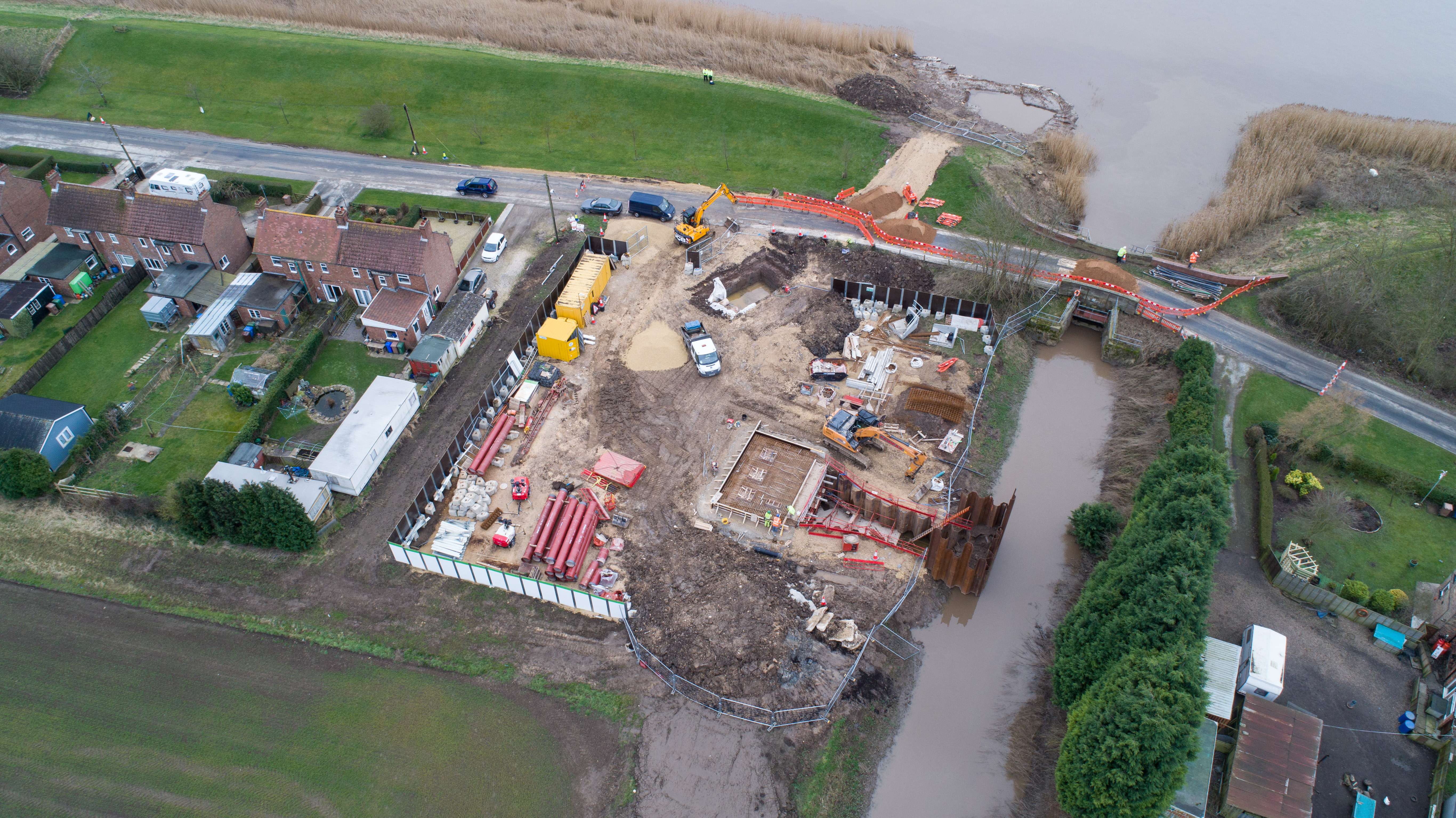
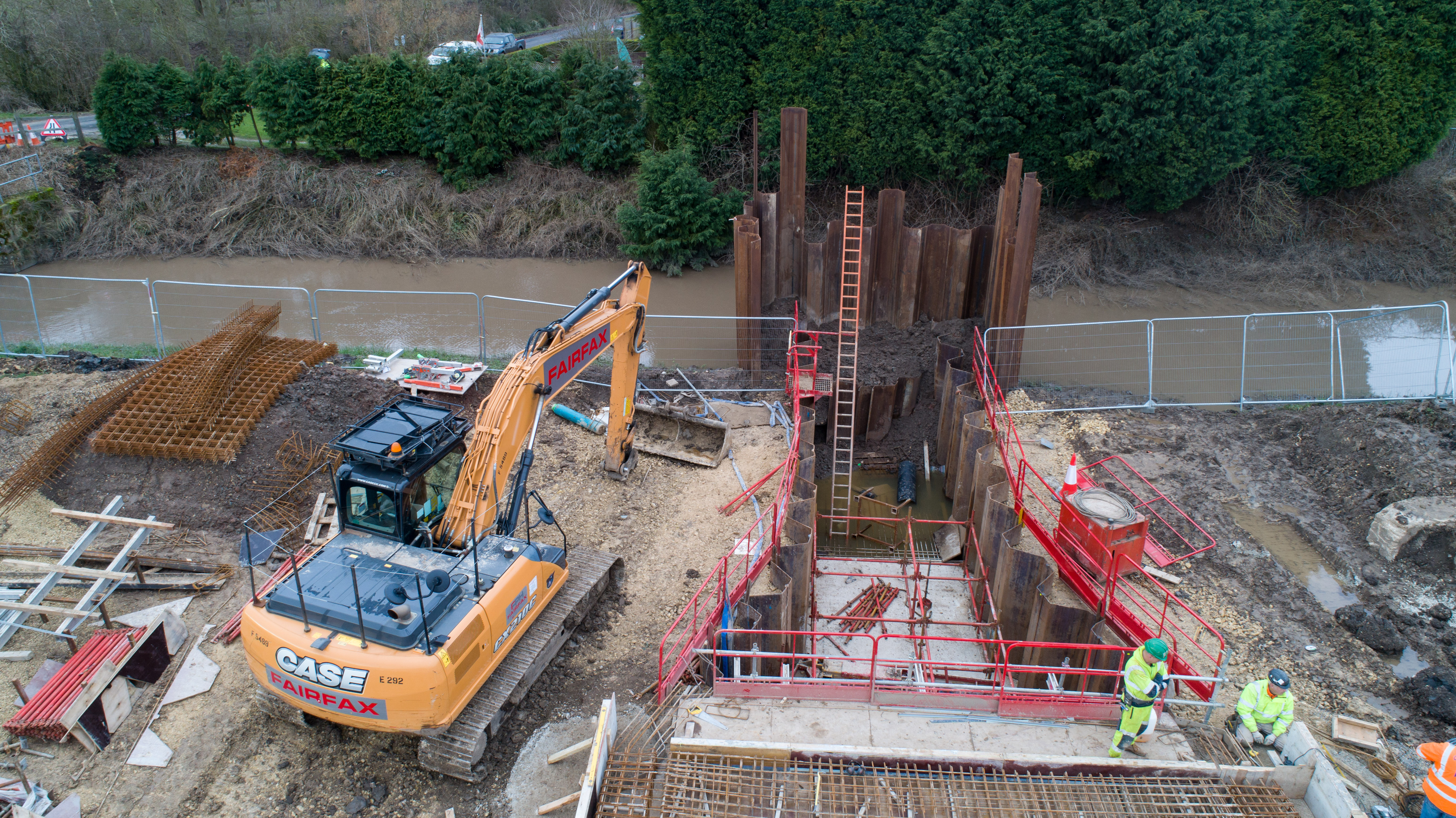
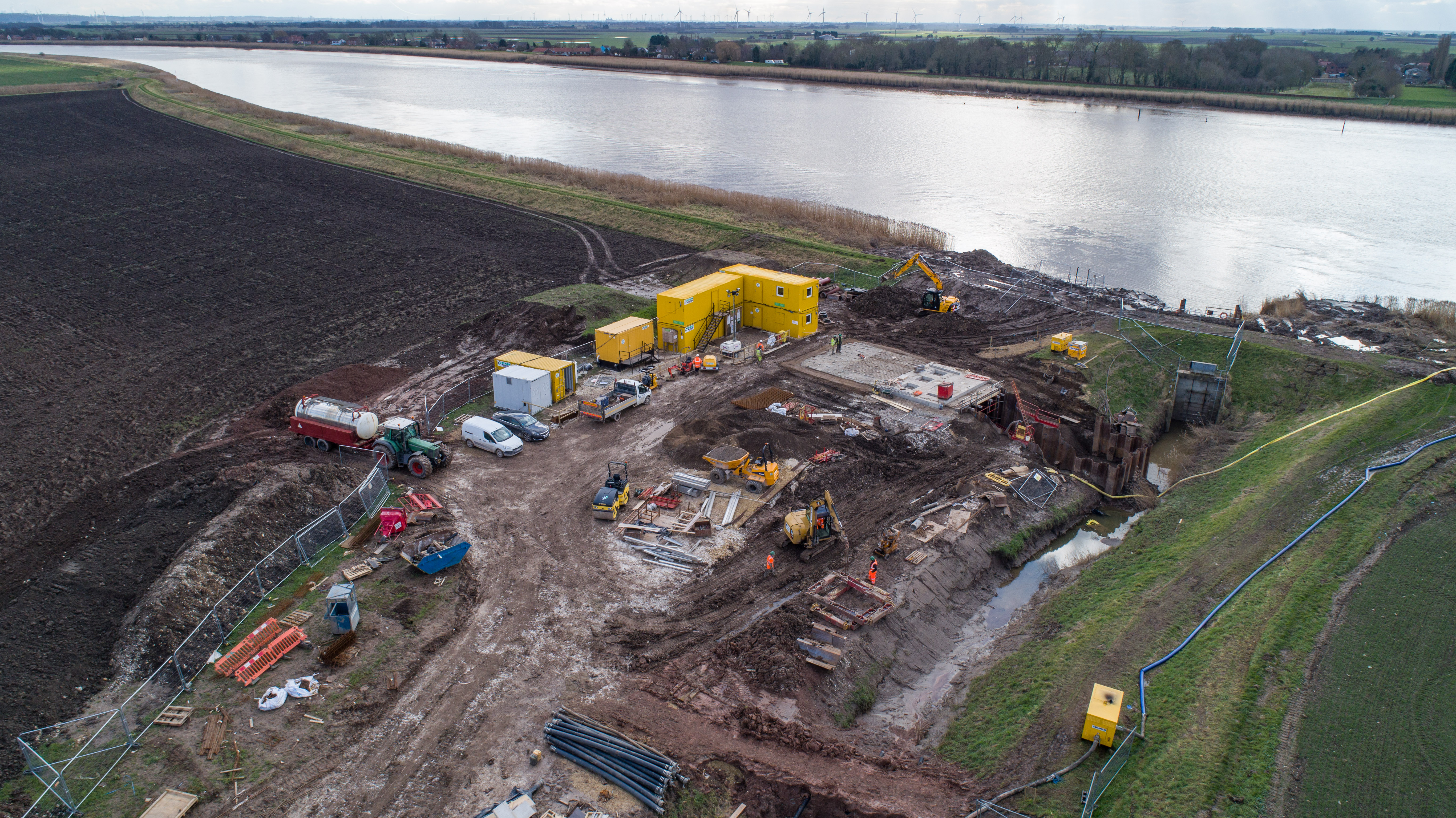
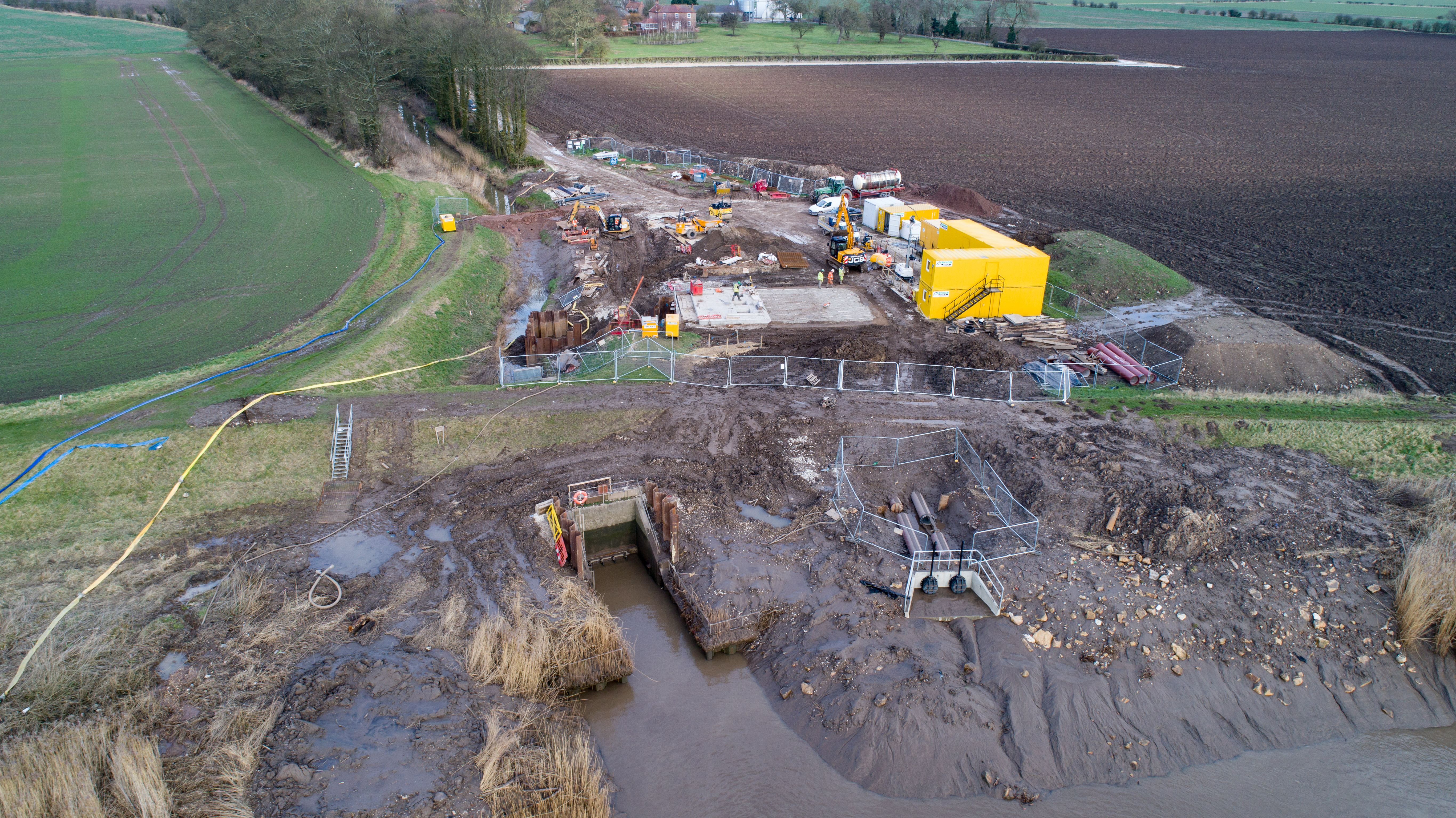
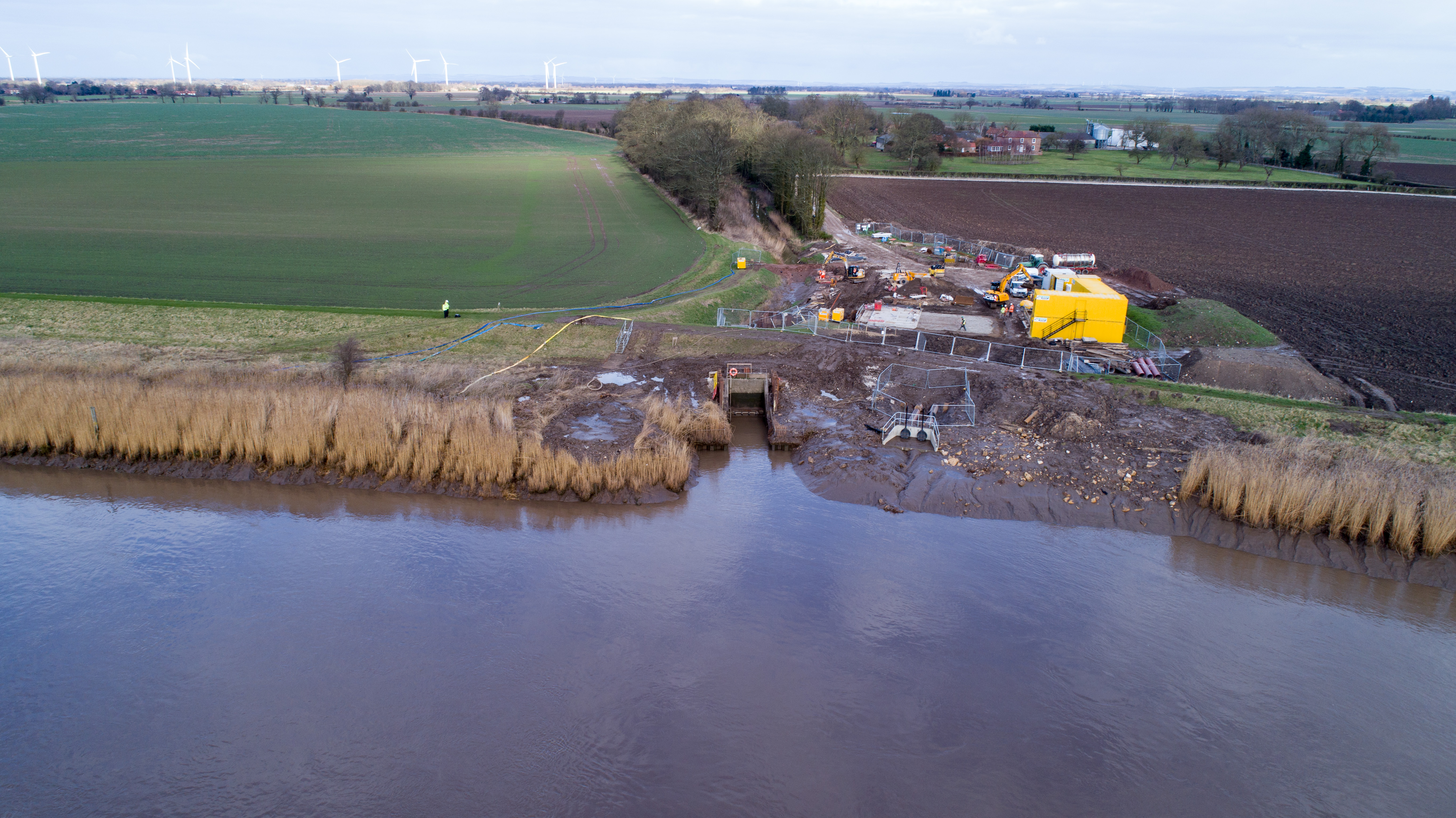
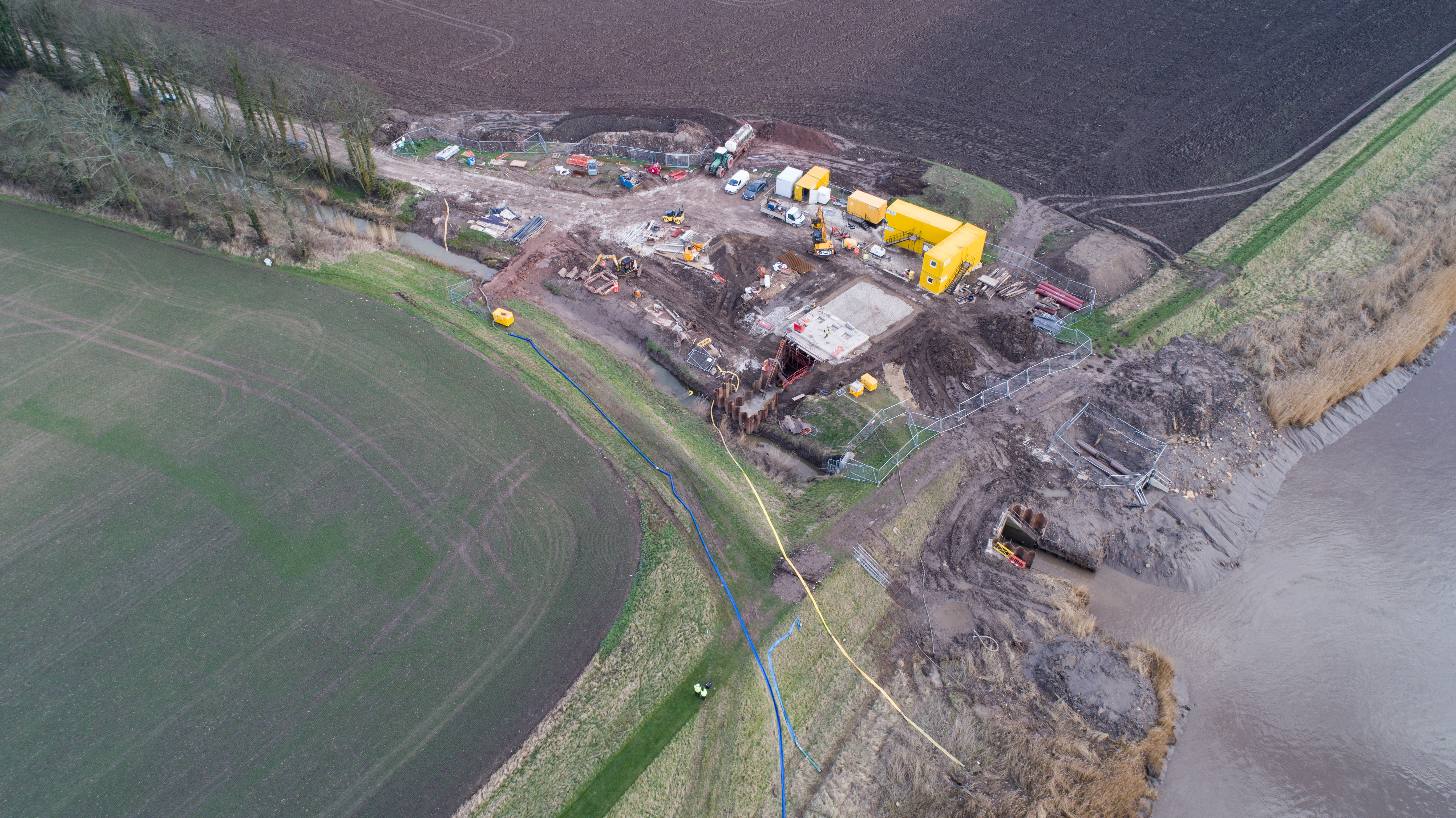
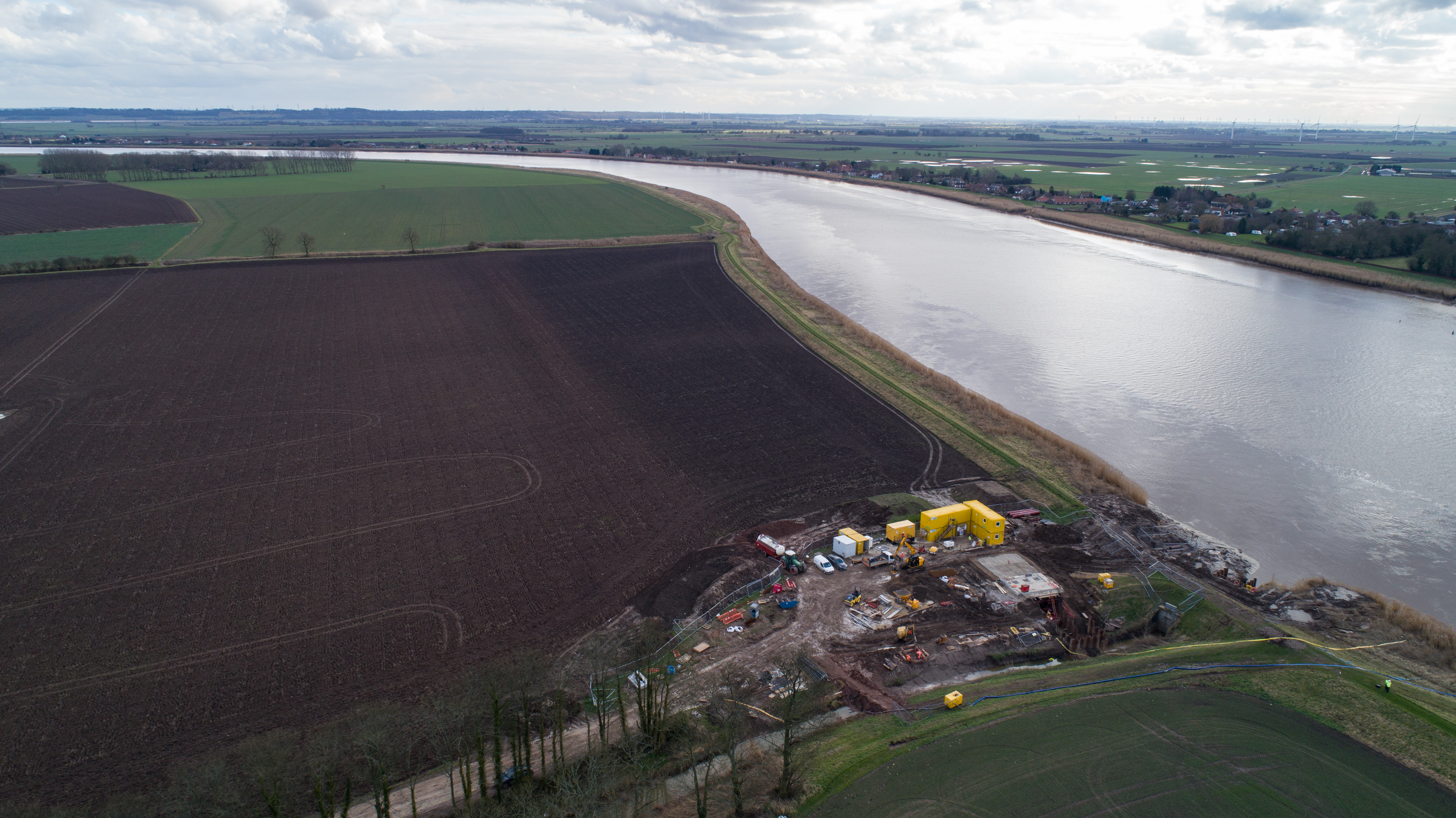
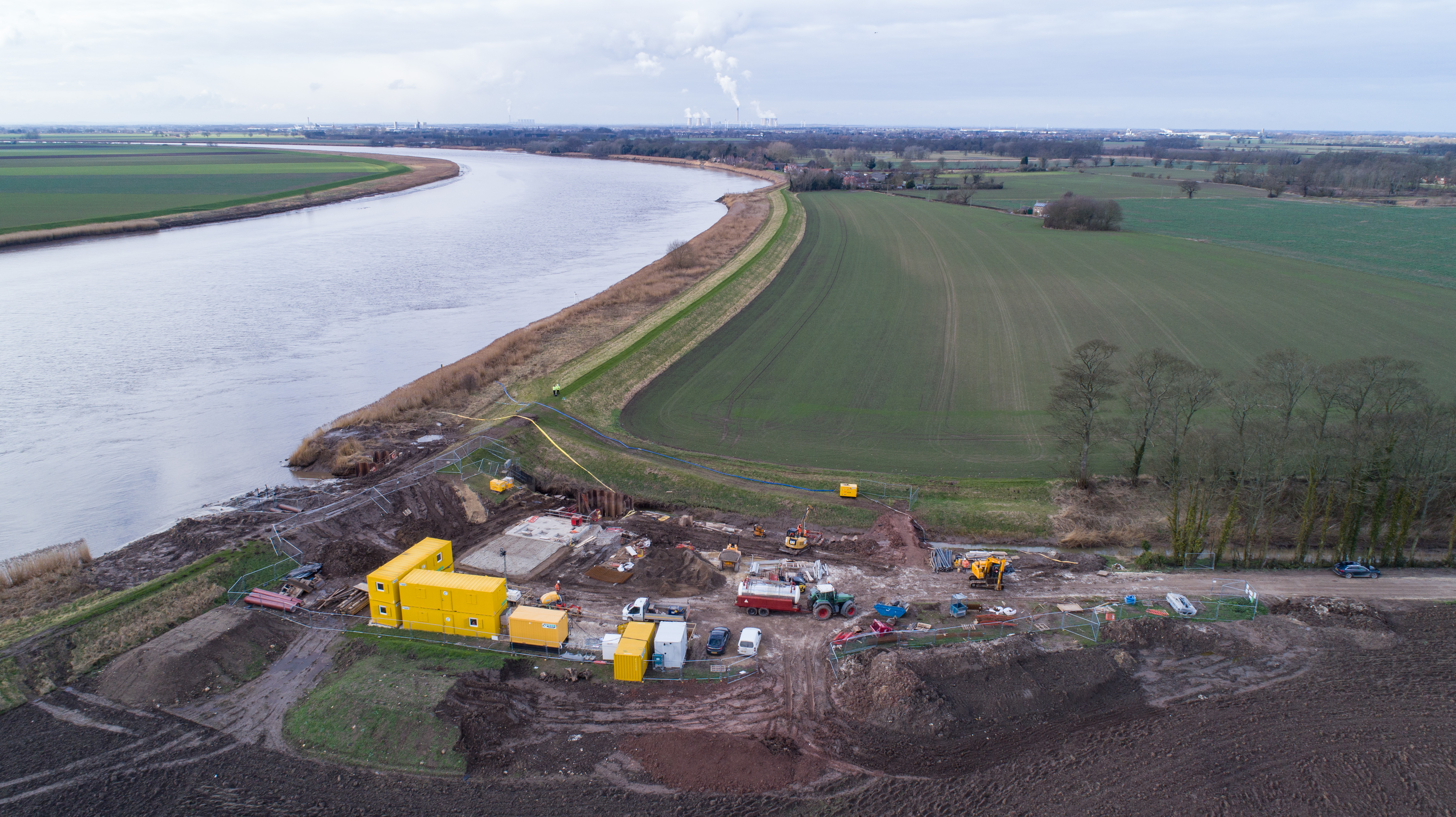
Everything came good with the weather a few days ago to shoot the two new pumping stations that are being erected
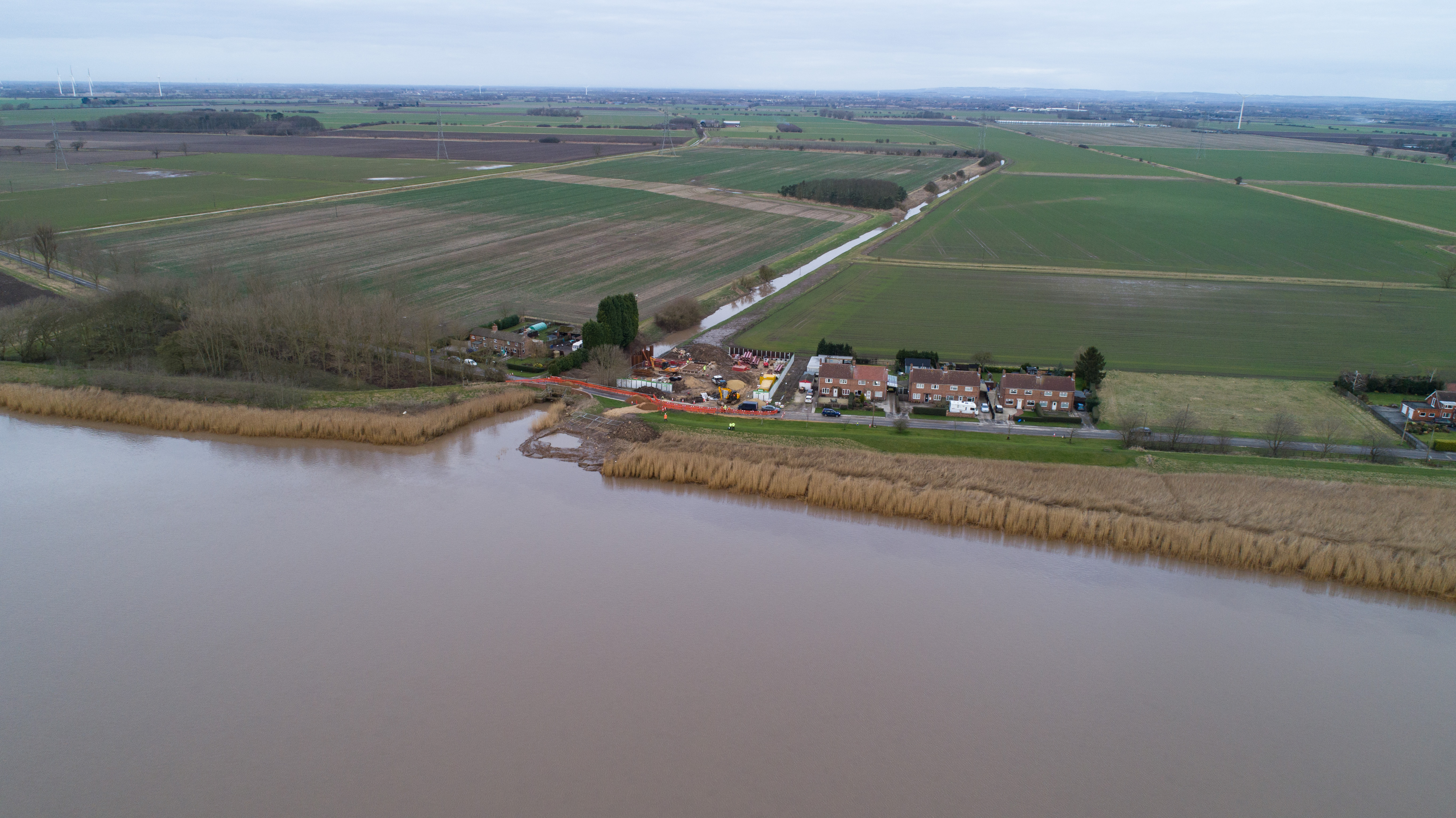
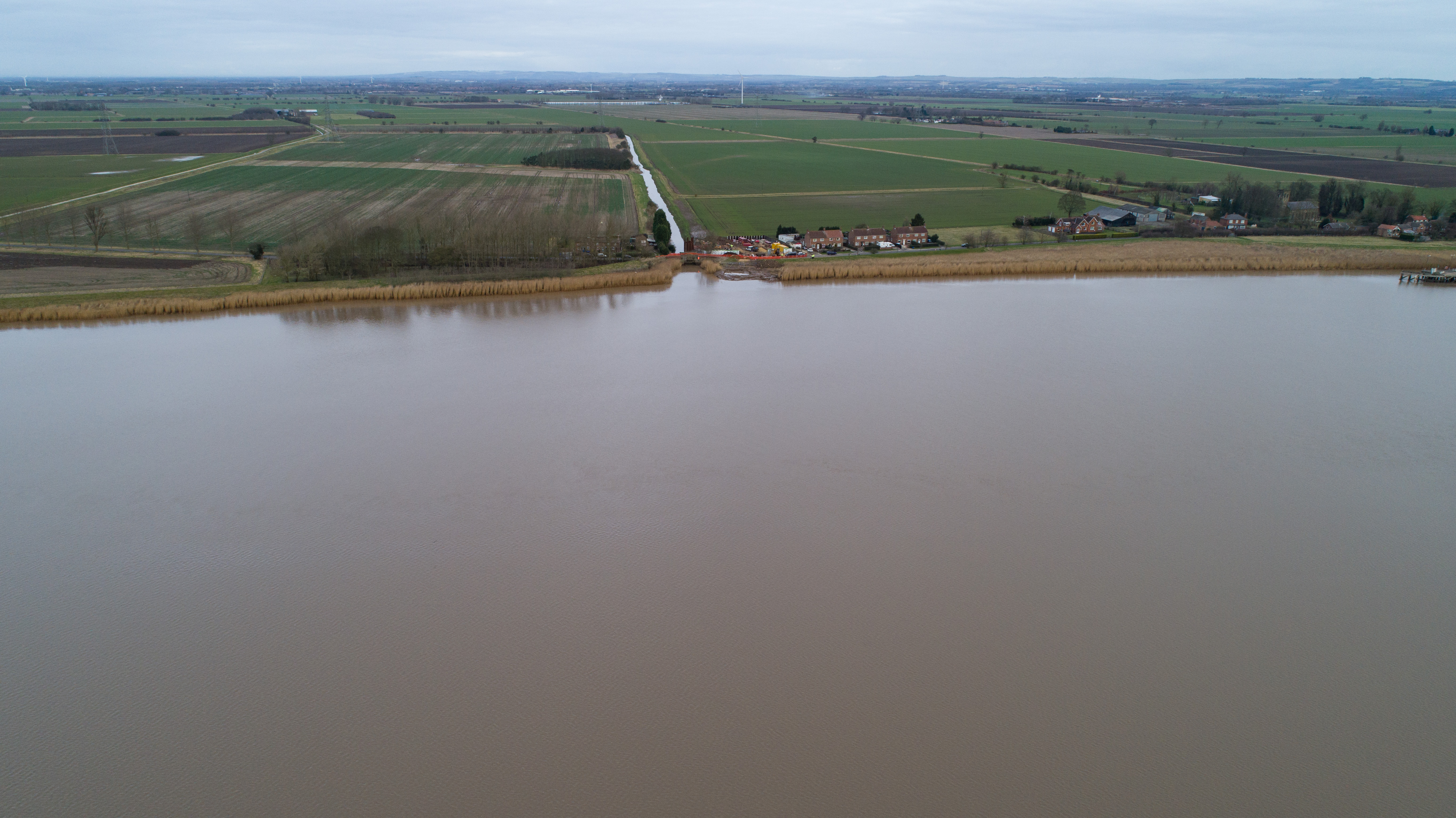
The humber has a tidal rise and fall of up to 6 metres and at times this can cause the river to overflow into fields and villages.
When they come on line in the spring, the stations will pump water back into the Humber to prevent it from overflowing its banks and causing damage to crops and property.
Safety First for Drone Flights
We were to photograph and video two locations from the air. The first was at Blacktoft a small riverside village and the second was more remote at Laxton.
Although we had permission to take off and land at both locations from ESH and the drainage board, we were close to houses at Blacktoft so the first thing to do was to go door knocking to alert any residents at home that there would be a drone in the air and what we were doing.
After that it was a case of doing a full recce of the sites, checking the drones, carrying out our pre flight checks and risk assessments before we took off to fly the tasks.
Fish & Eel friendly installation by Lumsden & Carroll
The pumps to be installed are ‘fish and eel friendly’ and are designed to pass high tide flood water from the ditches to the river. Associated pipework and outfalls will be constructed at each site to connect the pumping stations to the river. An electrical control building compound will be constructed adjacent to the pump stations together with access routes from the road.
A ‘fish and eel friendly’ tidal flap valve is to be installed at both locations after the existing tidal doors are removed. This will prevent tidal water flowing upstream in the ditches, but will allow a small flow through a secondary smaller flap valve to allow safe fish and eel passage.
Aerial Photographs
We took a series of aerial photographs of the sites first before we switched to video. Our aerial photographs are shot in raw which means we get the highest quality and definition possible.
If you click on any photograph it will render full size and you can then scroll through the gallery using your side arrows or the arrow on the screen
Aerial Video
After we had finished the aerial photographs we landed, switched batteries, changed to video and were up in the air again in a couple of minutes to shoot 4k video of both sites.
If you click the little square at the bottom right hand side of the video it will then take you to the full screen version
Can we help you?
If you need either hi-res aerial photographs or high definition 4k aerial video of a project please contact us at studio@footprintphoto.biz or call 07964 10 9 8 7 6 / 0114 225 5466